Showing posts with label Ashoka's Edict. Show all posts
Friday, January 3, 2014
Tuesday, February 5, 2013
A Discourse by Ace Archaeologist Mr K. K. Muhammed
Tuesday, February 05, 2013
Archaeological Survey of India, Ashoka's Edict, buddha, Buddhism, Hsuan Tsang, India, Latest Events, Nalanda, Travel, Xuanzang
0 comments
Whenever people asked me what's next on my bucket list, I would think of many destinations but never did I thought about 'Bihar' (State of India).. But after attending an inspiring discourse by ASI's Regional Director (retd.), Mr. K.K. Muhammed on the 'History of Buddhism through the Archaeological Excavations in various parts of Bihar
and UP', organised by India International Center on Feb 1, my perception about Bihar transformed completely..
He, during the discourse, spoke about how he and his team conducted successful excavations and conservation projects in areas like Nalanda, Vikramshila, Vaishali, Kesaria, Rajgir and Sarnath (M.P.), the challenges faced by ASI like removing human settlement over possible archaeological sites (as in the case of Vaishali and Nalanda), building of religious monuments over historical sites, e.t.c.
Mr Muhammed (who headed the Patna Circle of the ASI) shared with us anecdotes (apparently the half buried Ashokan Pillar of ancient Vaishali was used by a farmer to tie his cattle), his personal experiences while dealing with government apathy (apparently the Indian Railways was insisting to build a railway line over a mound which later turned out contain a 1400 year old stupa, Mr Muhammad had to start excavating the site without legal permission to unearth the stupa and foil the Railways' archaeologically disastrous plan).
Mr Muhammed showed rare pictures taken by British archaeologists of the mounds which contained the ruins of the Nalanda University and really old pictures of mounds containing the stupa's of Kusinagar, Vikramshila University, Rajgir, Kesariya e.t.c.
He also described the immense value Chinese traveler Hsuan Tsang's (above) (who visited India during the 7th century) journals had for Indian archaeologists and historians. Many significant stupas were located with the help of his journals as all other records were lost.
After this discourse it became clear to me that it would not be entirely fair to criticise the ASI for not conserving monuments as (in the words of Mr Muhammed) the government does not realise the fact that building 5 star hotels would not boost tourism.. Conserving monuments and archaeological treasures would..
Archaeologist Mr Muhammed displays a picture of a mound which contained a very important stupa
He, during the discourse, spoke about how he and his team conducted successful excavations and conservation projects in areas like Nalanda, Vikramshila, Vaishali, Kesaria, Rajgir and Sarnath (M.P.), the challenges faced by ASI like removing human settlement over possible archaeological sites (as in the case of Vaishali and Nalanda), building of religious monuments over historical sites, e.t.c.
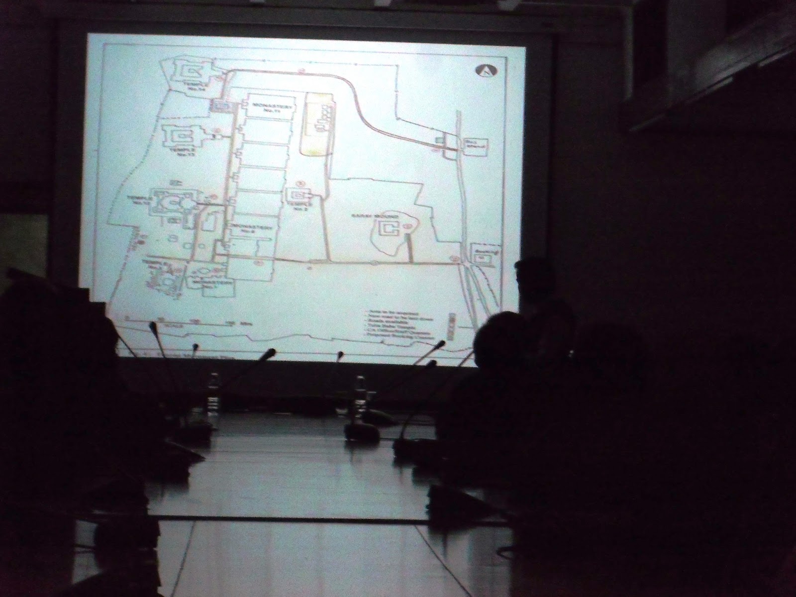
Site Map of the 1400 year old Nalanda University
Mr Muhammed (who headed the Patna Circle of the ASI) shared with us anecdotes (apparently the half buried Ashokan Pillar of ancient Vaishali was used by a farmer to tie his cattle), his personal experiences while dealing with government apathy (apparently the Indian Railways was insisting to build a railway line over a mound which later turned out contain a 1400 year old stupa, Mr Muhammad had to start excavating the site without legal permission to unearth the stupa and foil the Railways' archaeologically disastrous plan).
Mr Muhammed displays the progress of excavations over the Kesariya stupa, the highest in the world
Observe a 150 years old pic (behind the speaker) of the mound which covered the ruins of Nalanda University
Mr Muhammed showed rare pictures taken by British archaeologists of the mounds which contained the ruins of the Nalanda University and really old pictures of mounds containing the stupa's of Kusinagar, Vikramshila University, Rajgir, Kesariya e.t.c.
Portrait of famous Chinese traveler and monk Hsuan Tsang
Picture Source - Wikipedia
He also described the immense value Chinese traveler Hsuan Tsang's (above) (who visited India during the 7th century) journals had for Indian archaeologists and historians. Many significant stupas were located with the help of his journals as all other records were lost.
Archaeologist Mr K. K. Muhammed
After this discourse it became clear to me that it would not be entirely fair to criticise the ASI for not conserving monuments as (in the words of Mr Muhammed) the government does not realise the fact that building 5 star hotels would not boost tourism.. Conserving monuments and archaeological treasures would..
Tuesday, January 31, 2012
The Legacy of Delhi Vol 1 - An Introduction
Tuesday, January 31, 2012
Ancient Delhi - Pre 1300 AD, Ashoka's Edict, Delhi, Delhi (Pre 1600 A.D.), Delhi-iteful Tuesdays, India, Indraprastha, Indus Valley Civilization, New Delhi, Series - The Legacy of Delhi
0 comments
(Begining from now, the bi-monthly editions of Delhi-iteful Tuesdays are going to present a new and extremely informative insight into the treasures of the city of Delhi, it's seven former capital cities, in the series The Legacy of Delhi. Read and Enjoy.)
New Delhi (28°36′36″N 77°13′48″E) is the capital of India. It's total area is 1484 square kms or 573 sq miles and within this area seven capital cities (of the kingdoms of their time) and other numerous military garrisons (which also served as capitals of the kingdoms of their time) were established.
What made successive rulers choose the location (where Delhi stands today) millennium after millennium to choose the same spot to build their capitals ? What were those capitals like ? Did they serve their Purpose ? Do their ruins still remain and Can we still see them ? It is questions like these and more which will be answered in this special series called 'The Legacy of Delhi'. Read On..
The Genesis -
Since the Sun first dawned over the Indian Subcontinent ( which includes countries like India, Pakistan, Bangladesh, Nepal e.t.c.) people started to move in to this part of Earth, which is separated from the rest of Asia by a continuous mountain system, to make this place their own. Initially there was area for everybody. So people worked, traded and dwelled in peace (for example The Indus Valley Civilization). They established relations with civilizations beyond the subcontinent (like the Mesopotamians).
But as time kept flowing by, more and more people (e.g. Aryan tribes) migrated, from Central Asia, into the subcontinent to make this land their own and therefore the space or the land available began
to lessen. As a result conflicts arose and when conflicts arose the need
for establishing supremacy came up. When the societies and the manner of governance in the
Indian Subcontinent became more organized kingdoms began to be formed and the rulers started to expand their dominions across
the subcontinent.
Gradually, the concept of having large kingdoms arose when rulers began to emerge with large powerful armies and good administrative skills. For example,the Mauryan Empire under the rule of Chandragupta Maurya, Bimbisara and Asoka the Great started to expand their empires successfully until it encompassed the entire subcontinent.
Now, with the advent of large
empires the need for greater coordination amongst the armed forces in
the event of an attack by an invading force was felt. Also in order to smoothen
the process of tax collection the capital of the empire had to be
located in a particular location from where the coordination of the
armed forces and that of the administration could take place smoothly. So when
large empires began to be setup in north India especially by invaders from Central
Asia the search for the ideal capital led them to Delhi.
Physical Map of Delhi
**
New Delhi (28°36′36″N 77°13′48″E) is the capital of India. It's total area is 1484 square kms or 573 sq miles and within this area seven capital cities (of the kingdoms of their time) and other numerous military garrisons (which also served as capitals of the kingdoms of their time) were established.
What made successive rulers choose the location (where Delhi stands today) millennium after millennium to choose the same spot to build their capitals ? What were those capitals like ? Did they serve their Purpose ? Do their ruins still remain and Can we still see them ? It is questions like these and more which will be answered in this special series called 'The Legacy of Delhi'. Read On..
The Genesis -
Since the Sun first dawned over the Indian Subcontinent ( which includes countries like India, Pakistan, Bangladesh, Nepal e.t.c.) people started to move in to this part of Earth, which is separated from the rest of Asia by a continuous mountain system, to make this place their own. Initially there was area for everybody. So people worked, traded and dwelled in peace (for example The Indus Valley Civilization). They established relations with civilizations beyond the subcontinent (like the Mesopotamians).
The Indus Valley Civilization (the biggest urban centers of the Indus valley are underlined in Red while the location of the city of Delhi, which was uninhabited then, is highlighted in Green)
Gradually, the concept of having large kingdoms arose when rulers began to emerge with large powerful armies and good administrative skills. For example,the Mauryan Empire under the rule of Chandragupta Maurya, Bimbisara and Asoka the Great started to expand their empires successfully until it encompassed the entire subcontinent.
A replica of Ashoka's major rock Edict at Girnar, Gujarat, India
Through these edicts, which were placed across the Indian subcontinent (India, Pakistan, Bangladesh, Nepal), Emperor Ashoka proclaimed his beliefs in the Buddhist concept of dharma and his efforts to develop the dharma throughout his kingdom. Although Buddhism and the Buddha
are mentioned, the edicts focus on majorly over social and moral precepts of
Buddhism.
The naming of Delhi -
There are various theories which suggest how the city got his name, all of them interesting to read, but the first reference about the name(of the location) Delhi seems to have been made when Raja Dhilu built a city nearby in the 1st century B.C.
Vibudh Shridhar (an accomplished writer of his times) in his book Pasanah Chariu (The Conduct of Parshva) provides the first 'written' historical reference to the name 'Dhilli' (it is pronounced in the same manner as Delhi would be pronounced in Hindi).
As per the lines written in his book - 'There are countless villages in Haryana (look at the map below) country. The villagers there
work hard. They don't accept domination of others, and are experts in
making the blood of their enemies flow. Indra himself praises this
country. The capital of this country is 'Dhilli'
Geographical Location - Once you observe the location of Delhi in the Indian Subcontinent on the map above it would reveal to you how advantageous the position of Delhi must have been to the former rulers keeping in mind
the fact that Afghanistan(from where the majority of invasions took place) is neither too far nor too close to the
capital. This locations was not in an aggressive location nor in a very defensive location which is why the city either ended up being ransacked by the invading army or the armies of the ruler of Delhi would take the battle against the enemy right into Afghanistan.
One other reason for rulers(Hindu) to choose Delhi as capital was because Delhi is said to be located in the very spot where the fabled city of Pandavas (of Mahabharata), Indraprastha once stood.
This was the first post in the series of The Legacy of Delhi. Next post would be over Indraprastha (The fabled city of the Pandavas)
Co-Written by Traveler Fahad and R Yamuna
**
You can now join our Facebook Page for beforehand information and exclusive pictures.
Please Note:- The geographical map has been sourced from vidiani.com under the Creative Commons Attribution-ShareAlike 3.0 Licence.